20120903 Graphic evidence of Hurricane ISAAC tidal Storm Surge documented with ARGUS data logger:


20120830 1100hrs UPDATE - Heavens help us all if ISAAC turns south and joins with another hurricane?

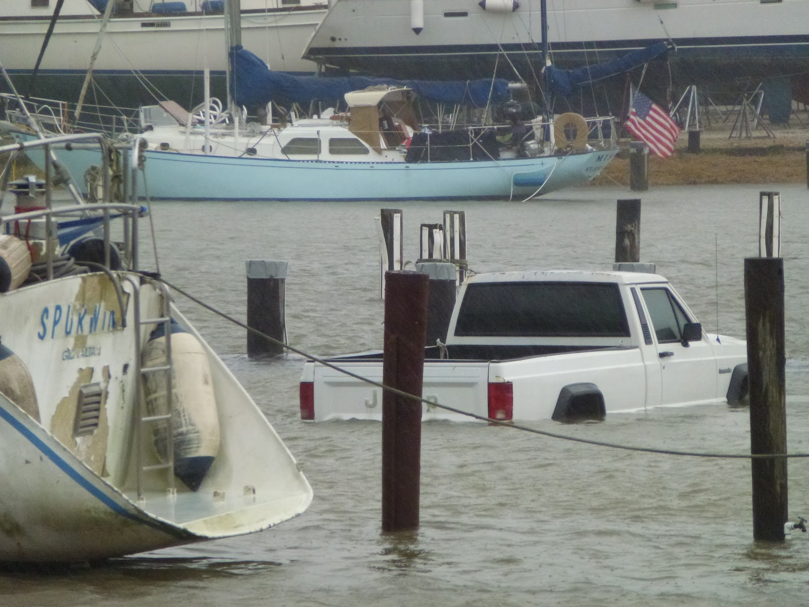
20120830 0700hrs UPDATE - Waters having trouble draining - flooding remains with water over the dock.


Alabama Stats:
There are 816 occupants in the general need shelters
There are 567 state employees to include the Alabama National Guard mobilized
There are 172 occupants in the medial need shelters
There are 44 Alabama Mutual Aid Teams on stand-by (they can assist with search and rescue, debris removal and etc.)
There are 8 regional law enforcement teams on stand-by
There are 7 roads currently closed (Baldwin-4 and Mobile-3)
The NWS is predicting 5 feet of storm surge before water recedes later this evening
There are 2 State Trooper Districts monitoring traffic flow
There are 2 Department of Transportation Districts monitoring roadways for potential flooding
The Emergency Operations Center remains activated at level 1

And the rain keeps coming - barrel after barrel - tidal wave after tidal wave.....

20120829 1800hrs UPDATE - Waters starting to drain leaving debris over roadways...


20120829 0900 UPDATE - Storm surge waters this morning are only a foot more than yesterday (about 3 feet total over flood stage) and winds are reducing after overnight 40-50kt gusts. Rains are reducing - next 24 hrs will be 3-5" of rain - dodged another bullet. All is well aboard M/V GREY GOOSE.
On-scene weather for Dog River Marina is available here: http://www.wunderground.com/sailing-weather/beach:Dog%20River%20Marina%208595
20120829 1200 UPDATE - Winds less than 35kts with minimal storm surge - it's slowing down and just cresting over the docks... out on Mobile Bay - just the other side of the Dog River Bridge there are 4-6 foot waves breaking on shore... looks like we have dodged the bullet for one more day - wait until tomorrow's high tide in the AM - storm surges tend to be slow moving events...


20120828 0900 UPDATE - ISAAC winds increasing while storm surge starts pushing inshore and flooding... like a dream... in slow motion.


Transient dock is full with boats passing through which decided to stay in port rather than be out on their own in unfamiliar territory or on a river which is filling up with boats from coastal communities like Orange Beach AL, Pensacola FL etc...


No comments:
Post a Comment